
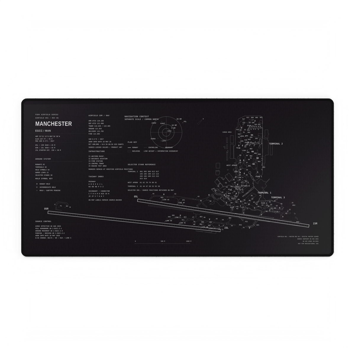
A runway is used for takeoff and landing; taxiways provide routes for aircraft moving on the ground. On an airport layout, identify them from the labels and the drawing's key before relying on their shape. A long, straight strip beside a runway may be a taxiway, so “the long one” is not a sufficient answer.
Separate the airport from the drawing
A photograph shows markings on pavement. A diagram represents features using its own symbols, line weights and labels. An artwork may simplify those features again. Before comparing two lines, establish which kind of image you are reading.
The FAA's Airport Marking Aids and Signs guidance describes US pavement markings: runway markings are white, while taxiway and holding-position markings are yellow. Holding-position markings can be yellow even on a runway. The normal taxiway centreline is continuous; a runway centreline has spaced stripes and gaps.
Those pavement conventions do not mean a white line in a monochrome airport illustration must be a runway. Use the illustration's key. Nor is colour alone a complete identification method.
Read in this order
Find how the drawing represents a runway, a taxiway and a building. If there is no key, record that limitation.
Read the identifier attached to the feature. Follow its position or leader line instead of assigning the nearest text by guesswork.
Look at the surrounding connections. Use the overall arrangement to check your reading, not to replace the label.
This is an original FGR4 reading checklist for enthusiasts, not an operational airport diagram or a taxi instruction.
Try a one-feature exercise
Open an airport diagram with a published key. Choose one feature, write down its label and note which part of the key supports your identification. Then find a second feature of a different type. If you cannot explain the difference using the document itself, leave it unresolved rather than adding a confident caption.
For a pavement-marking comparison, look at the runway centreline and normal taxiway centreline sections in the linked FAA guide. Keep that exercise separate from reading a stylised layout.
Bring that distinction back to aviation artwork
The Manchester artwork shown above is an owned FGR4 product visual. Its fine lines and labels are part of a desk-mat composition; viewing it here does not establish current airport conditions or permission to move around an airfield.
Our runway-number guide covers a different question: what the runway identifiers mean. The airfield geometry article looks at composition, while the aircraft-or-airport comparison helps you choose a subject for your desk.
Next step: choose one labelled feature in a diagram and explain your answer using its key. Reading one feature carefully is more useful than guessing the whole airport at once.